NASA Precipitation
Rain, snow, and other forms of precipitation affect every part of life on Earth. Rain falls on the crops we eat, fills the reservoirs of water we drink, and is an integral part of everyday weather and long term climate trends. This website, presented by NASA’s Global Precipitation Measurement (GPM) mission, provides students and educators with resources to learn about Earth’s water cycle, weather and climate, and the technology and societal applications of studying them.
1. Ground Validation and OLYMPEX Webquest
In this webquest, you will learn how we measure precipitation from the ground and from space using satellites, and why we need to do ground validation (also called ground truthing) of the satellite data. You will also learn about the OLYMPEX Field Campaign which will look at precipitation in the Olympic Peninsula of Washington State from November 2015 until January of 2016.
PART 1: Measuring Precipitation
PART 2: Looking at Data
The full webquest
2. OLYMPEX Advanced Data Analysis Exercise
Once scientists have collected their ground and satellite data, they need to do the mathematics to compare and see how well they match in order to make adjustments to the computer data processing algorithm as needed. You are going to do that process yourself, using citizen science rain gauge data and satellite data from NASA
The full webquest
3. Active and Passive Remote Sensing Diagram
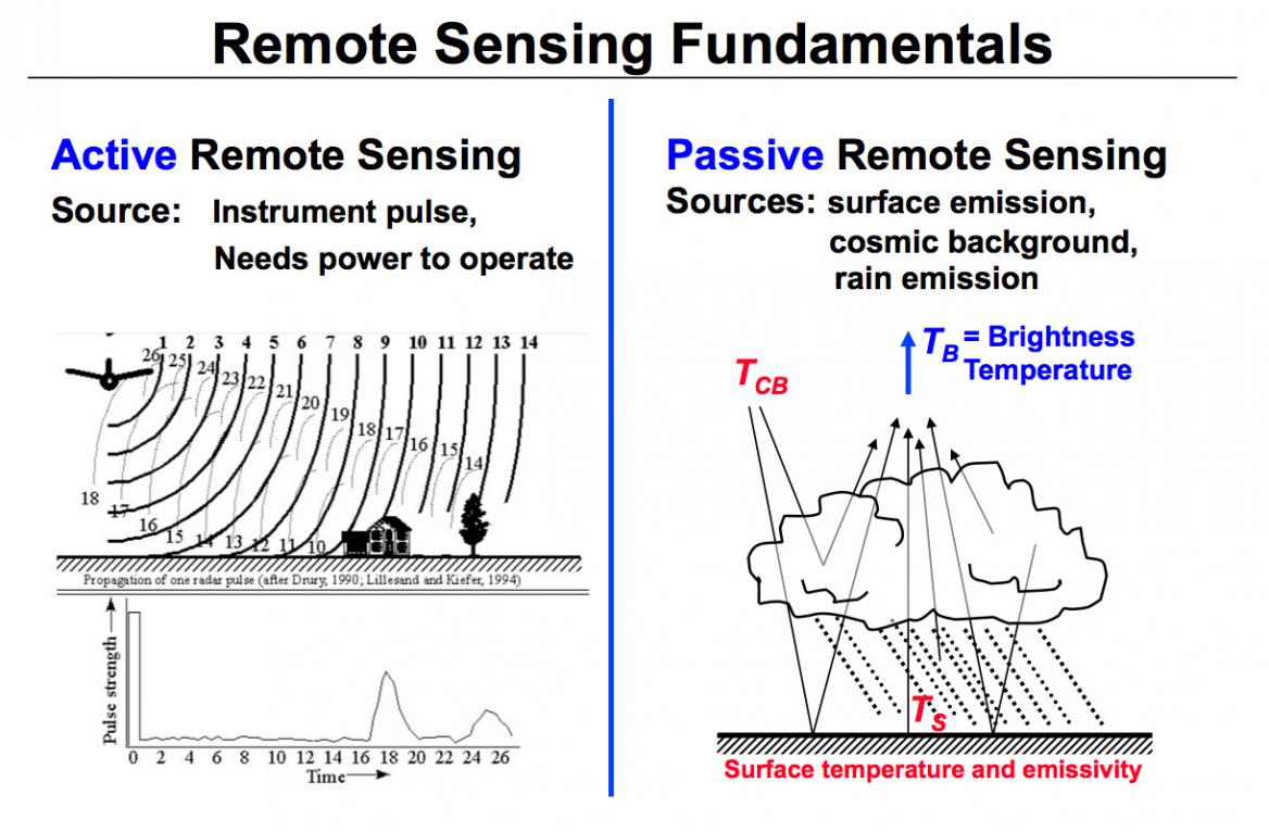
This diagram illustrates the differences between active and passive remote sensing. TRMM (the Tropical Rainfall Measuring Mission) and GPM (the Global Precipitation Measurement) rely on active and passive instruments to measure the properties of precipitation from space.
Active radars, such as the TRMM Precipitation Radar, transmit and receive signals reflected back to the radar. The signal returned to the radar receiver (called radar reflectivity) provides a measure of the size and number of rain/snow drops at multiple vertical layers in the cloud (Left figure).
Passive precipitation radiometers, such as the TRMM Microwave Imager, measure natural thermal radiation (called brightness temperatures) from the complete observational scene including snow, rain, clouds, and the Earth's surface (Right figure).
4. The Water Cycle
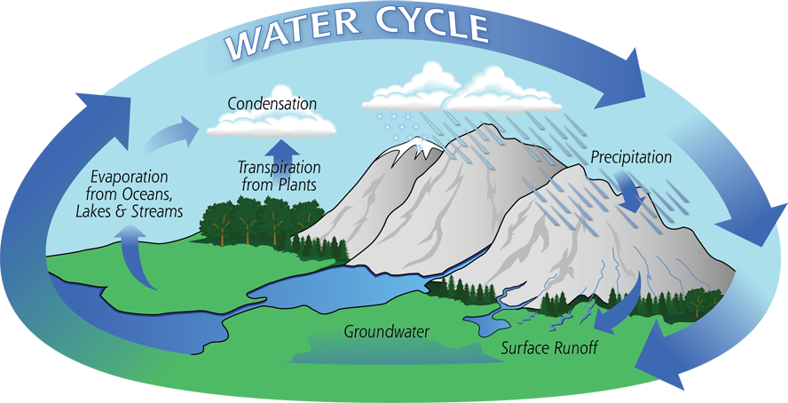
The water cycle describes how water evaporates from the surface of the earth, rises into the atmosphere, cools and condenses into rain or snow in clouds, and falls again to the surface as precipitation. The water falling on land collects in rivers and lakes, soil, and porous layers of rock, and much of it flows back into the oceans, where it will once more evaporate. The cycling of water in and out of the atmosphere is a significant aspect of the weather patterns on Earth.
5. Understanding Earth: Whats Up With Precipitation?
Understanding the role of precipitation in Earth’s water cycle and how it interacts with other Earth systems requires a global view. The distribution of water throughout the atmosphere and how it moves, changing between its solid, liquid, and gaseous forms, is a powerful vehicle for redistributing Earth’s energy and influences the behavior of the planet’s weather, climate, and other environmental systems.
6. Satellite Meteorology Learning Modules
Satellite Meteorology learning modules provide scientists and educators with exciting activities and hands-on tools for investigation, inquiry, analysis and stewardship.
Meteorology is an excellent topic to introduce middle and high school students to geoscience, physics, chemistry and applied mathematics. Satellite Meteorology learning modules provide scientists and educators with exciting activities and hands-on tools for investigation, inquiry, analysis and stewardship.