Open-source GNSS processing toolbox in python programming environment
Using GNSS datasets to estimate the precipitable water vapor and open-source tools for GNSS data processing in python programming environment.
1. Methods to estimate precipitable water vapor using GNSS datasets
Precipitable water vapor (PWV) is an important variable in meteorology and hydrology. It is a direct indicator of atmospheric water vapor content. It can be used to estimate many other climate parameters. For example, forecasting hourly intense rainfall (Benevides, 2019).
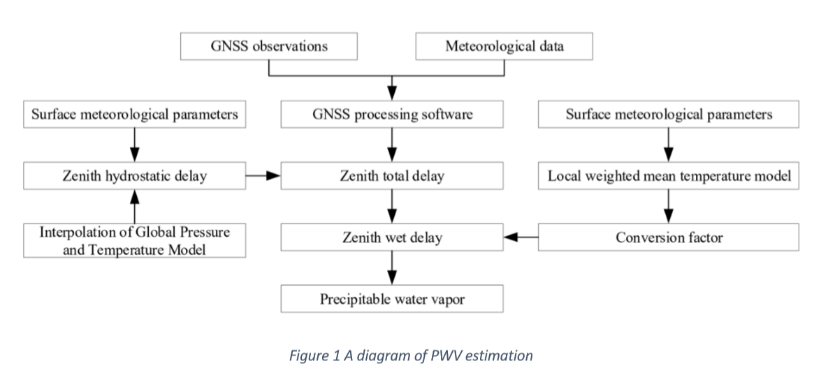
The methods of using GNSS to estimate PWV assumes that wet components of the atmosphere delay the signals proportionally to PWV (Bevis, et al., 1992). As the number of GNSS satellites has grown significantly, the spatial and temporal distribution of GNSS datasets is a promising technology to estimate PWV. Figure 1 shows a diagram of estimating PWV (Liu, 2019).
2. Open-source GNSS processing toolbox in python programming environment.
Python is an object oriented, general purpose programing language that is easy to use and fast in implementation. Thus, it is useful to use an open-source package in python as the GNSS datasets are difficult to parse and retrieve needed parameters.
Laika is an example python package which can be used for processing GNSS datasets. It is an easy to implement open-source tool that can be extended for precipitable water vapor (PWV) analysis and estimation.
The laika package was installed and tested. It is recommended to download its source code from its github repository and then install running the command:
>> python setup.py install
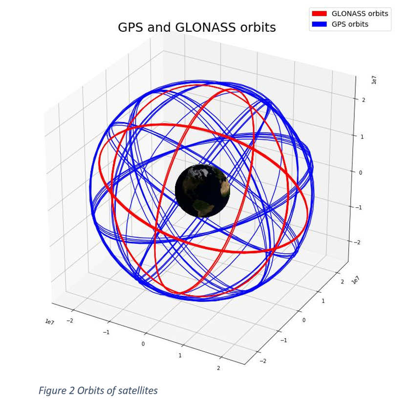
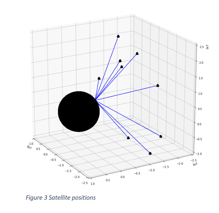
There are some useful examples in jupyter notebooks (Laika, 2019). Figure 2 and Figure 3 demonstrates some results of using laika package. To download and see more
3 References
Benevides, P. C. (2019). Neural Network Approach to Forecast Hourly Intense Rainfall Using GNSS Precipitable Water Vapor and Meteorological Sensors. Remote Sensing.
Bevis, M., Businger, S., Herring, T., Rocken, C., Anthes, R., & Ware, R. ( 1992). GPS meteorology: Remote sensing of atmospheric water vapor using the global positioning system. . Journal of Geophisical research.
Laika. (2019). Simple Python GNSS processing library. Retrieved from https://github.com/commaai/laika.
Liu, C. Z. (2019). A New Method for Refining the GNSS-Derived Precipitable Water Vapor Map. . Sensors.
Report of Abdikaiym Zhiyenbek here